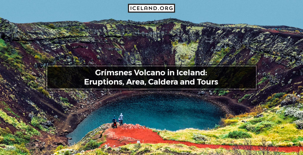
The Grímsnes Volcano is a crater row or fissure-type volcanic system located in the southern parts of Iceland. The apex of Grímsnes is 214 meters high. As a volcanic system, Grímsnes consists of three individual craters, with the lake-filled Kerið being the most famous one. The Grímsnes Volcano is surrounded by the Grímsneshraun lava fields and lies close to the Thingvallavatn lake. Grímsnes was active between 6500 and 5500 years ago. Today, it classifies as an inactive volcano. Grímsnes and other volcanoes in Iceland are popular tourist attractions.
Where is the Location of Grímsnes Volcano in Iceland?
The Grímsnes Volcano is located in South iceland. More specifically, it is situated on the Reykjanes Peninsula, southeast of Thingvallavatn lake. The geographic coordinates of Grímsnes are 64.0333° N, 20.8667° W.
When did Grímsnes Volcano Erupt last time?
Grímsnes last erupted in 3500 BCE. Historically speaking, the volcano’s activity has been limited to a short timeframe. Today, the Grímsnes Volcano is inactive.
What are the Features of Caldera of Grímsnes?
Grímsnes has three volcanic craters, called Kerið, Seyðishólar, and Kerhóll. Kerið is best-known mainly because it was formed only 3000 years ago, making it almost twice as younger compared to the surrounding calderas. The Kerið caldera of the Grímsnes volcano measures 270 meters in length, 170 meters in width, and 55 meters in depth.
What are the scientific expeditions for Grímsnes Volcano?
Scientists like geologists and volcanologists collect ingenious rocks from the Grímsnes Volcano to learn more about its activity and formation of volcanic landforms. There are also popular scientific expeditions for tourists for the Grímsnes Volcano.
What are the Tours for Grímsnes Iceland?
Tours for Iceland often include visiting Grímsnes and its lake-filled Kerið volcanic crater. Hikes to the crater are available starting from many nearby and distant localities. The hike is not very physically demanding. Grímsnes is an attraction regardless of the season.
