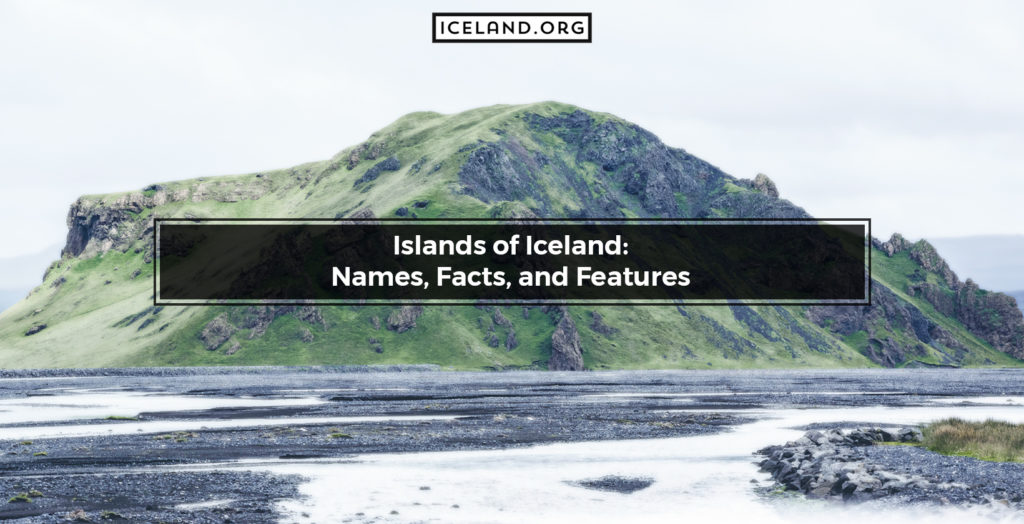
With an area of 103.000 square kilometers, Iceland is the 18th largest island in the world. Interestingly, Iceland has 30 smaller islands of its own and more than one thousand rocks and skerries. Despite a large number of islands, only four of them are inhabited, and those are Flatey in Breiðafjörður, Grímsey, Hrísey, and Heimaey. However, even the ones that are not inhabited are important for geographical and geological reasons. Also, some islands are popular tourist attractions, while others are best left undisturbed as they serve as nesting spots for various bird species. The features of iceland‘s islands constantly change due to volcanic eruptions and subsequent water erosion. The largest island in Iceland is Heimaey which is located off the north coast and is also the main island of the famous Westman Islands.
Here is a list of the Islands of Iceland.
- Akurey (0.07 square kilometers)
- Álsey (0.25 square kilometers)
- Bjarnarey (0.4 square kilometers)
- Borgarey (0.5 square kilometers)
- Brandur (0.1 square kilometers)
- Brimilsnes (0.6 square kilometers)
- Brokey (3.7 square kilometers)
- Drangey (0.2 square kilometers)
- Eldey (0.02 square kilometers)
- Eldeyjarboði (<0.01 square kilometers)
- Elliðaey (0.45 square kilometers)
- Engey (0.4 square kilometers)
- Flatey in Breiðafjörður (0.5 square kilometers)
- Flatey in Skjálfandi (2.8 square kilometers)
- Geirfuglasker (0.02 square kilometers)
- Geldungur (0.02 square kilometers)
- Grímsey (0.43 square kilometers)
- Heimaey (13.4 square kilometers)
- Hellisey (0.1 square kilometers)
- Hergilsey (0.2 square kilometers)
- Hjörsey (5.5 square kilometers)
- Hrappsey (1.7 square kilometers)
- Hrísey (8 square kilometers)
- Húsey (0.06 square kilometers)
- Hvalbakur (0.01 square kilometers)
- Jólnir (0.0 square kilometers)
- Kolbeinsey (0.0 square kilometers)
- Langey (1.1 square kilometers)
- Lundey (0.03 square kilometers)
- Málmey (2.4 square kilometers)
- Mánáreyjar (0.08 square kilometers)
- Melrakkaey (0.73 square kilometers)
- Nesbjörg (0.38 square kilometers)
- Nýey (0.0 square kilometers)
- Papey (2.0 square kilometers)
- Skáleyjar /
- Suðurey (0.2 square kilometers)
- Súlnasker (0.03 square kilometers)
- Surtsey (1.2 square kilometers)
- Svefneyjar /
- Sviðnur /
- Viðey (1.7 square kilometers)
- Vigur (0.4 square kilometers)
- Þerney (0.4 square kilometers)
- Æðey (1.2 square kilometers).
1. Akurey
Akurey Island in Iceland is located in the southwest. Akurey Island’s coordinates are 64.1729° N, 21.9640° W. Akurey Island is one of the five historic islands near the capital Reykjavik, and it was first mentioned in writings from 1379. The capital bought Akurey in 1969 and leased it out. Since 1978 and up until today, Akurey has been part of the Municipality of Reykjavik. Tours and Tour Guides for Akurey Island in Iceland are available. Akurey is a true paradise for tourists and locals enjoying bird watching. The island houses around 60% of the world’s Atlantic puffin nests. Based on the season, visitors may even see pufflings. Other seabirds such as fulmars and guillemots are also densely populated in Akurey.
2. Álsey
Álsey Island in Iceland is located in the south. The Álsey Island’s coordinates are 63.3979° N, 20.3700° W. Álsey is part of the Westman Islands archipelago, which counts 15 different islands of various sizes. Tours and Tour Guides for Álsey Island in Iceland are not available.
3. Bjarnarey
Bjarnarey Island in Iceland is located in the south. The Bjarnarey Island’s coordinates are 63.4477° N, 20.1893° W. Bjarnarey is the fourth largest island of the Vestmann Islands. Tours and Tour Guides for Bjarnarey Island in Iceland are available. Bjarnarey is a popular destination for tourists as it is home to one of the largest puffin colonies in the area. Plus, it is conveniently close to the only inhabited Westman Island, Heimaey.
4. Borgarey
Borgarey Island in Iceland is located in the northwest. Borgarey Island’s coordinates are 65.9717° N, 22.4483° W. Borgarey is the smallest and innermost island in the Ísafjarðardjúp fjord. Lacking freshwater, Borgarey is inhabited. Tours and Tour Guides for Borgarey Island in Iceland are not available. However, in summer, locals sail to Borgarey to collect eiderdown.
5. Brandur
Brandur Island in Iceland is located in the south of the country. Brandur Island’s coordinates are 63.3911° N, 20.3660° W. Brandur is part of the Westman archipelago. The Brandur Island is named after an old Icelandic tale according to which a cat named Brandur swam from one of the surrounding islands to this one. Tours and Tour Guides for Brandur Island in Iceland are not available.
6. Brimilsnes
Brimilsnes Island in Iceland is located in the east. Brimilsnes Island’s coordinates are 64.5650° N, 14.5319° W. Brimilsnes is a small and uninhabited island. Tours and Tour Guides for Brimilsnes Island in Iceland are not available.
7. Brokey
Brokey Island in Iceland is located in the west. Brokey Island’s coordinates are 65.0800° N, 22.4640° W. Brokey is the fifth largest island in Iceland and the largest one in the shallow Breiðafjörður bay. Tours and Tour Guides for Brokey Island in Iceland are available. Brokey is the birthplace of Jón Pétursson, a pioneer in raising eider ducks and falcon hunters.
8. Drangey
Drangey Island in Iceland is located in the north of the country. The Drangey Island’s coordinates are 65.9487° N, 19.6854° W. Drangey is a volcanic palagonite tuff and a remnant of an old volcano. Tours and Tour Guides for Drangey Island in Iceland are available. Drangey has a rich birdlife, consisting mostly of diving birds such as puffins, auks, and guillemots. Raven, fulmar, and falcon sanctuaries are also common. Drangey Island is mentioned in the Icelandic Drangey “Grettis saga” and is part of several folk tales about giants.
9. Eldey
Eldey Island in Iceland is located in the southwest. Eldey Island’s coordinates are 63.7408° N, 22.9580° W. Eldey is small but rises to incredible heights of 77 meters. The high altitude combined with sheer cliffs makes Eldey home to one of the largest colonies of northern gannet. In the past, it was also inhabited by auks, but they migrated following a volcanic eruption in 1830. Tours and Tour Guides for Eldey Island in Iceland are not available. The bird colonies can be watched through two webcams put on top of the island.
10. Eldeyjarboði
Eldeyjarboði Island in Iceland is located in the southwest. Eldeyjarboði Island’s coordinates are 63.4833° N, 23.8000° W. Eldeyjarboði is, in fact, a blind skerry and part of the Mid-Atlantic Ridge. In 1830, an underwater eruption occurred underneath Eldeyjarboði. Tours and Tour Guides for Eldeyjarboði Island in Iceland are available.
11. Elliðaey
Elliðaey Island in Iceland is located in the south. Elliðaey Island’s coordinates are 63.4644° N, 20.1756° W. Elliðaey is part of the Westman Islands and has no inhabitants. With the exception of puffins, there is scarce wildlife on the island. Tours and Tour Guides for Elliðaey Island in Iceland are not available. However, local hunters visit Elliðaey because there is a hunting lodge on the island. In fact, the lodge is the only house and is often referred to as “the loneliest house in the world.” There is a popular misconception that the famous Icelandic singer and artist Björk lives on Elliðaey island.
12. Engey
Engey Island in Iceland is located in the west. Engey Island’s coordinates are 64.1708° N, 21.9159° W. Engey is the second-largest island of the Faxa Bay and one of the five historic islands near Reykjavik. Tours and Tour Guides for Engey Island in Iceland are not available. The only thing on the island is an old lighthouse that was built in 1902.
13. Flatey in Breiðafjörður
Flatey in Breiðafjörður Island in Iceland is located in the west. The Flatey in Breiðafjörður Island’s coordinates are 65.3739° N, 22.9192° W. Flatey in Breiðafjörður is a cluster of forty islands and islets forged under the extreme weight of a glacier during the previous Ice Age. Tours and Tour Guides for the Flatey in Breiðafjörður Island in Iceland are available. In winter, the island has only five inhabitants, but in summer, the number rises as many mainlanders have houses on Flatey in Breiðafjörður. There is only one road on the island, connecting the ferry dock with the so-called “Old Village.”
14. Flatey in Skjálfandi
Flatey in Skjálfandi Island in Iceland is located in the north. The Flatey in Skjálfandi Island’s coordinates are 66.1636° N, 17.8615° W. Flatey in Skjálfandi is called the flat island because it is only 22 meters elevated from the sea. Tours and Tour Guides for the Flatey in Skjálfandi Island in Iceland are available. In 1942 Flatey in Skjálfandi had 120 inhabitants today it is inhabited seasonally and often visited by fishermen catching cod and lumpfish.
15. Geirfuglasker
Geirfuglasker Island (Great Auk Skerry) in Iceland is located in the south. Geirfuglasker Island’s coordinates are 63.3177° N, 20.4979°W. Geirfuglasker is a small island and part of the Westman Islands archipelago. Tours and Tour Guides for Geirfuglasker Island in Iceland are not available.
16. Geldungur
Geldungur Island in Iceland is located in the south. The Geldungur Island’s coordinates are 63.3350° N, 20.4012° W. Geldungur belongs to the Westman Islands archipelago. Tours and Tour Guides for the Geldungur Island in Iceland are not available.
17. Grímsey
Grímsey Island in Iceland is located in the north of the country. Grímsey Island’s coordinates are 66.5423° N, 17.9961° W. Grímsey stands on the Arctic Circle in the large Húnaflói Bay. Grímsey is 40 kilometers away from the main coast. Despite its small size, Grímsey is inhabited and in 2011 had 86 habitants. Tours and Tour Guides for Grímsey Island in Iceland are available.
18. Heimaey
Heimaey Island (Home Island) in Iceland is located in the south. Heimaey Island’s coordinates are 63.4277° N, 20.2674° W. Heimaey is the main landmark of the Westman archipelago and the largest island in the country. With 4.500 inhabitants, it is also the most densely populated one. Heimaey Island was catastrophically damaged in January 1973 when the nearby Eldfell Volcano erupted, destroying half of the town. Tours and Tour Guides for Heimaey Island in Iceland are available.
19. Hellisey
Hellisey Island in Iceland is located in the southwest. The Hellisey Island’s coordinates are 63.3612° N, 20.3662° W. Hellisey is a small volcanic island and one of the country’s best paradises for birds. Tours and Tour Guides for the Hellisey Island in Iceland are not available.
20. Hergilsey
Hergilsey Island in Iceland is located in the west. The Hergilsey Island’s coordinates are 65.4328° N, 23.0178° W. Hergilsey is a small and uninhabited island in the large Breiðafjörður Bay. Tours and Tour Guides for Hergilsey Island in Iceland are not available.
21. Hjörsey
Hjörsey Island in Iceland is located in the west. The Hjörsey Island’s coordinates are 64.5269° N, 22.3497° W. Situated in the Faxaflói Bay, Hjörsey is the third largest island in Iceland. Tours and Tour Guides for Hjörsey Island in Iceland are not available. Hjörsey is not inhabited by people, but there are herds of wild horses roaming its lands.
22. Hrappsey
Hrappsey Island in Iceland is located in the west. The Hrappsey Island’s coordinates are 65.1167° N, 22.6000° W. Hrappsey is a small and uninhabited island. Tours and Tour Guides for the Hrappsey Island in Iceland are not available.
23. Hrísey
Hrísey Island in Iceland is located in the north. Hrísey Island’s coordinates are 65.9954° N, 18.3837° W. Hrísey is the second largest island in Iceland and is situated in the Eyjafjörður fjord. Hrísey has a population of 120 people and is one of the few continuously inhabited islands since the settlement of Iceland. Tours and Tour Guides for Hrísey Island in Iceland are available. Hrísey is a popular bird-watching destination. Lacking natural predators, the island is a sanctuary to various species like eider duck, Arctic tern, and ptarmigan.
24. Húsey
Húsey Island in Iceland is located in the west. Húsey Island’s coordinates are 64.6339° N, 22.4939° W. Located in Faxaflói bay, Húsey is the largest landmass of the 20 islands and skerries known as Hvalseyjar. Tours and Tour Guides for Húsey Island in Iceland are not available.
25. Hvalbakur
Hvalbakur Island in Iceland is located in the east. Hvalbakur Island’s coordinates are 64.6000° N, 13.2333° W. Hvalbakur is the easternmost point of Iceland and 35 kilometers away from the mainland. Tours and Tour Guides for Hvalbakur Island in Iceland are not available.
26. Jólnir
Jólnir Island’s coordinates were 63.2947° N, 20.6328° W. Jólnir is a volcanic island that emerged from the ocean as a vent of Surtsey, after an eruption in 1966. Today, Jólnir is eroded. Tours and Tour Guides for Jólnir Island in Iceland are not available.
27. Kolbeinsey
Kolbeinsey Island in Iceland is located in the north. Kolbeinsey Island’s coordinates are 67.1167° N, 18.6000° W. Kolbeinsey is the former northernmost point of Iceland. Today, Kolbeinsey is eroded but still visible during low tides. If watched from above, Kolbeinsey looks like two separate skerries. Tours and Tour Guides for Kolbeinsey Island in Iceland are not available.
28. Langey
Langey Island (Long Iceland) in Iceland is located in the west. The small but long Langey Island is located within the Breiðafjörður Bay. Tours and Tour Guides for Langey Island in Iceland are not available.
29. Lundey
Lundey Island (Puffin Island) in Iceland is located in the southwest. The Lundey Island’s coordinates are 64.1870° N, 21.8302° W. Lundey is one of the five historic islands near Reykjavik. Tours and Tour Guides for Lundey Island in Iceland are available. Tourists may enjoy bird watching as Lundey is a real bird paradise housing several species like puffins, fulmars, Arctic terns, and black guillemots.
30. Málmey
Málmey Island in Iceland is located in the north. Málmey Island’s coordinates are 66.0172° N, 19.5346° W. Together with Drangey and Lundey, Málmey is located within the Skagafjörður Bay. Until a devastating fire in 1950, Málmey was inhabited by 15 people. Today, the island is uninhabited. Tours and Tour Guides for Málmey Island in Iceland are not available. Málmey Island is mentioned in the popular Icelandic saga “Sturlunga.”
31. Mánáreyjar
Mánáreyjar Island in Iceland is located in the north. Mánáreyjar Island’s coordinates are 66.2981° N, 17.1179° W. Mánáreyjar refers to two smaller islands near the Tjörnes Peninsula. Tours and Tour Guides for Mánáreyjar Island in Iceland are not available.
32. Melrakkaey
Melrakkaey Island in Iceland is located in the west. The Melrakkaey Island’s coordinates are 64.9850° N, 23.3028° W. Melrakkaey was inhabited in the past. Today, Melrakkaey Island is a protected area because of the dense bird population. Visiting Melrakkaey Island is illegal. It is also illegal to hunt on the island as well as in its immediate surrounding. Tours and Tour Guides for the Melrakkaey Island in Iceland are not available.
33. Nesbjörg
Nesbjörg Island in Iceland is located in the east. Nesbjörg Island’s coordinates are 65.5572° N, 20.5842° W. The small Nesbjörg Island is situated in the Álftafjörður fjord. Tours and Tour Guides for Nesbjörg Island in Iceland are not available.
34. Nýey
Nýey Island in Iceland is located in the southwest. Nýey emerged in 1783 following a submarine volcanic eruption and existed only for a year. Today, the island is eroded, and the remaining part is a small skerry named Eldeyjarboði. Tours and Tour Guides for Nýey Island in Iceland are not available.
35. Papey
Papey Island in Iceland is located in the west. Papey Island’s coordinates are 64.5934° N, 14.1660° W. The island has been inhabited since the settlement of Iceland and up until 1966. Today, Papey houses large puffin colonies, a lighthouse, a church, a dwelling house, and an automated weather station. Tours and Tour Guides for Papey Island in Iceland are available.
36. Skáleyjar
Skáleyjar Island in Iceland is located in the west. Skáleyjar Island’s coordinates are 65.4440° N, 22.6410° W. Skáleyjar includes 150 small islands scattered in the large yet shallow Breiðafjörður Bay. Tours and Tour Guides for Skáleyjar Island in Iceland are available.
37. Suðurey
Suðurey Island in Iceland is located in the south of the country. Suðurey Island’s coordinates are 63.3881° N, 20.3211° W. The small Suðurey Island is part of the Westman Islands archipelago. Tours and Tour Guides for Suðurey Island in Iceland are not available.
38. Súlnasker
Súlnasker Island in Iceland is located in the south of the country. Súlnasker Island’s coordinates are 63.3307° N, 20.3988° W. Súlnasker is small and part of the Westman Islands. Tours and Tour Guides for Súlnasker Island in Iceland are not available.
39. Surtsey
Surtsey Island in Iceland is located in the south. Surtsey Island’s coordinates are 63.3023° N, 20.6011° W. The volcanic Surtsey island is the second largest of the Westman Islands and the southernmost point of Iceland. It emerged after a volcanic eruption in 1963. When the eruption was over, Surtsey had an area of 2.7 square kilometers. Over the years, due to water erosion, its size decreased, and in 1975 it was 2.5 square kilometers. Today, Surtsey is only 1.2 square kilometers. Tours and Tour Guides for Surtsey Island in Iceland are not available.
40. Svefneyjar
Svefneyjar Island in Iceland is located in the west. Svefneyjar Island’s coordinates are 65.3731° N, 22.8181° W. Svefneyjar is a group of 63 small islands in the Breiðafjörður Bay. Tours and Tour Guides for Svefneyjar Island in Iceland are not available.
41. Sviðnur
Sviðnur Island in Iceland is located in the west. Sviðnur Island’s coordinates are 65.4115° N, 22.6111° W. Sviðnur is in fact, a group of 20 small islands in the Breiðafjörður Bay. Tours and Tour Guides for Sviðnur Island in Iceland are not available.
42. Viðey
Viðey Island in Iceland is located in the southwest. The Viðey Island’s coordinates are 64.1643° N, 21.8529° W. Viðey is the largest of Reykjavík’s five historic islands (together with Akurey, Engey, Lundey, and Þerney). Tours and Tour Guides for Viðey Island in Iceland are available. The Viðey Island is well-vegetated with over 156 plant species and has more than 30 different birds.
43. Vigur
Vigur Island in Iceland is located in the north. Vigur Island’s coordinates are 66.0555° N, 22.8289° W. Situated just below the Arctic Circle, Vigur is the second-largest island in the Ísafjarðardjúp fjord. Vigur is famous for its thriving bird colonies. Tours and Tour Guides for Vigur Island in Iceland are available. Vigur houses the northernmost windmill in the world, which was built in 1840.
44. Þerney
Þerney Island in Iceland is located in the southwest of the country. The Þerney Island’s coordinates are 64.1846° N, 21.7834° W. Þerney is one of the five historic islands of Reykjavik. Tours and Tour Guides for Þerney Island in Iceland are available.
45. Æðey
Æðey Island in Iceland is located in the west. The Æðey Island’s coordinates are 66.0949° N, 22.6614° W. Æðey is a small island, and today it is inhabited by one family working in its privately owned farm. Tours and Tour Guides for Æðey Island in Iceland are available.
What are the facts about Islands in Iceland?
Today, Iceland has over 30 named islands and more than one thousand rocks and skerries. Some of the islands are volcanic and have developed as a result of submarine eruptions. Others have been wiped by eruptions and water erosion. The islands in Iceland are an important geographic feature, and together with the other natural wonders and breathtaking landforms, they attract over 2.000.000 tourists per year.
How many islands are in Iceland?
In Iceland, there are over 30 islands and more than one thousand skerries and rocks. These landforms are scattered off the coast of Iceland but are most densely distributed in the west and south-western parts of the country, in the small bays and fjords.
What is the biggest Island in Iceland?
The biggest island in Iceland is Heimaey. Located off the west coast of Iceland, Heimaey belongs to the Westman Islands Archipelago. Today, its area is 13.4 square kilometers, but before the Eldfell’s eruption in 1973, the Heimaey Island’s surface was 11.2 square kilometers. The current population of Heimaey is 4.500 people and 8.000.000 puffins.
What is the smallest Island in Iceland?
The smallest island in Iceland is Kolbeinsey. Also representing the northernmost point of Iceland, Kolbeinsey consists of two separate skerries, which are only visible when the tides are low. In the past, Kolbeinsey was a larger island, but years of erosion took their toll, making it the smallest island on Iceland.
What are the Geographical Features located in Iceland Islands?
The geography of Iceland is marked by unusual and strikingly contrasting features and landforms. Interestingly, the geographical features located on the islands of Iceland are:
- Volcanoes: Eldfell Volcano, Helgafell Volcano
- Ridges: Reykjanes Ridge
- Forests: Hrútey Forest.
Is there life on Iceland’s islands?
Yes, four of Iceland’s islands are populated. Those are Flatey in Breiðafjörður, Grímsey, Hrísey, and Heimaey. With an area of 13.4 square kilometers, the largest of these islands is Heimaey which also has the densest population. Namely, the population of Heimaey Island is 4.500 people. In contrast, the total population of Iceland is 368.792.
What creatures live on the islands of Iceland?
Birds are the most common Animals of Iceland living on its islands. There are various bird species such as Atlantic Puffins, auks, eider duck, Arctic terns, fulmars, ptarmigans, black guillemots, etc. On some islands, there are also herds of wild horses.
What is the prominence of Islands for Iceland Geography?
The islands of Iceland have a positive impact on the country’s economy. Namely, several islands are popular sights and attract tourists. Also, certain more remote islands are bird sanctuaries, thus enriching Iceland’s wildlife. Most of the islands are easily accessible via boats and relatively close to the mainland. Also, the islands feature their own landforms, such as rivers, mountains, lakes, and valleys. Due to the isolated nature of the islands, these geographic landforms remain intact and well-preserved.
What are the volcanic islands in Iceland?
The volcanoes of Iceland play a major role in the formation and disappearance of many of the country’s islands. Namely, volcanic eruptions make some islands emerge from under the water, increase the surface of others, and finally make some islands disappear completely. In Iceland, there are many volcanic islands, but perhaps the most imminent one is Surtsey. Tours to Surtsey are available and quite a popular attraction among Iceland visitors.
What are the Island Tours in Iceland?
There are many different island tours in Iceland. Some last half a day and others a couple of days, depending on the extent of the activities and landmarks they include. Popular tours include hikes, animal watching, visiting natural landforms, and photography courses and workshops. The prices start at around $50, and the best time to visit Iceland’s islands is summer as the climate is friendlies during such months. The tours to the islands of Iceland have a positive impact on the tourism developments and the country’s overall economy.
What are the Iceland Ferry Tours?
The Boat Tours of Iceland are popular among tourists. There are different types of tours; some offer transport to the nearby islands and others whale and bird watching activities. The exact cost of such tours depends on the activity type and their length.
Is it legal to swim to Iceland Islands?
Yes, it is legal to swim to Iceland’s islands. The only island to which access is not permitted is Melrakkaey Island in the western part of the country. Melrakkaey is a protected area that serves as a sanctuary for birds.
What is the effect of the Islands on Iceland’s Economy?
One of the main branches of the Economy of Iceland is tourism. Islands support this economic branch by attracting tourists. Some of the more popular islands of Iceland are attractive for locals too. For example, many islands are only inhabited during summer when locals move to their summer houses. All in all, Iceland’s islands have a positive impact on the country’s economy.
