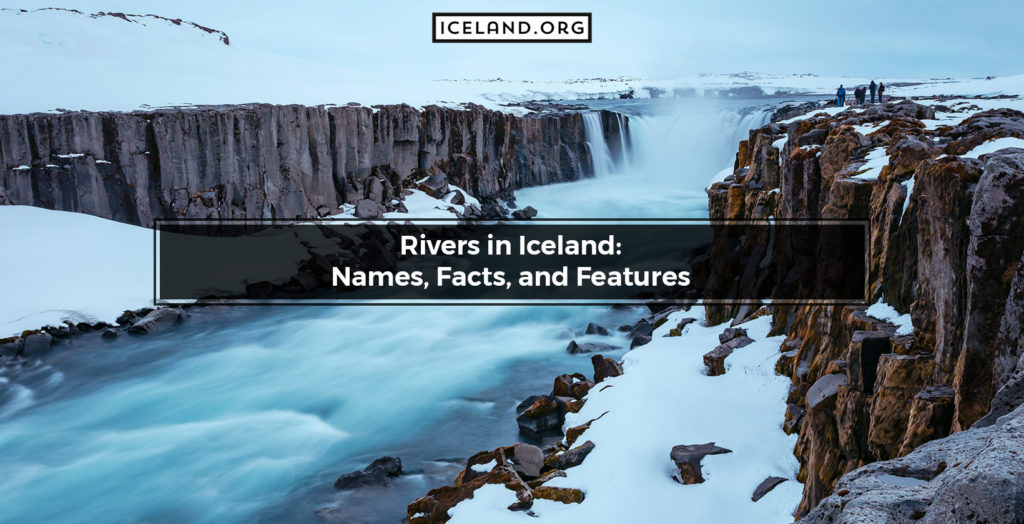
In Iceland, there are over 55 rivers. Some long and fast and others short and steady, some volcanic rivers and others glacier rivers. The Major Rivers in Iceland have cascade flows and feature differently sized waterfalls. The iceland Hot Spring River experience is another popular tourist attraction. The yellow rivers in Iceland are particularly striking because of their unique colors stemming from their volcanic origin. The largest river in Iceland is the Þjórsá River. It is 230 kilometers long, and its name translated in English means “The River of Bulls.”
Here is a list of the rivers in Iceland.
- Norðurá (65 km)
- Fossá
- Hvítá (40 km)
- Krossá
- Kúðafljót (115 km)
- Markarfljót (100 km)
- Múlakvísl
- Rangá (55 km)
- Skaftá (115 km)
- Skeiðará (30 km)
- Skógá
- Sog
- Þjórsán (230 km)
- Tungnaá (129 km)
- Dynjandi
- Kolbeinsá (10 km)
- Staðará (8 km)
- Blanda (125 km)
- Eyjafjarðará
- Eystri Jökulsá
- Fnjóská (117 km)
- Glerá (18 km)
- Héraðsvötn (130 km)
- Hörgá (30 km)
- Jökulsá á Fjöllum (206 km)
- Laxá (93 km)
- Skjálfandafljót (178 km)
- Vatnsdalsá (40 km)
- Hamarsá
- Hofsá (85 km)
- Jökulsá á Dal (150 km)
- Jökulsá í Fljótsdal
- Jökulsá í Lóni
- Lagarfljót
- Selfljót.
The Major Rivers in Iceland are a remarkable tourist attraction year-round. The Top Rivers in Iceland ensure a striking landscape for visitors and an opportunity to enjoy some water sports and activities.
1. Norðurá Rivera
Norðurá River in Iceland is located in the central-western parts of the island. Norðurá River’s coordinates are 64.6806° N, 21.6369° W. Norðurá River is 65 kilometers long tributary of the Hvítá river and one of the top 10 salmon rivers in Iceland. Norðurá origins from the Holtavörðuvatn Lake and flows through the Borgarfjörður region. Tours and Tour Guides for the Norðurá River in Iceland are available. The Norðurá River is not volcanic.
2. Fossá River
Fossá River (Waterfall River) in Iceland is located in the southwest. Fossá River’s coordinates are 66.0333° N, 23.16666° W. Fossá is a medium-sized river flowing through the lava fields of Mount Hekla. Fossá got its name because it features various waterfalls, including the 128-meters tall Háifoss (High Waterfall), Granni (Neighbour), and Hjálparfoss (Helping Falls). Tours and Tour Guides for the Fossá River in Iceland are available. The Fossá River is not volcanic.
3. Hvítá River
Hvítá River (White River) in Iceland is located in the south. The Hvítá River’s coordinates are 64.5373° N, 19.7808° W. The Hvítá river is 40 kilometers long and is the most dangerous river in Iceland. As a glacier-type of river, Hvítá is the most important river in the Borgarfiord region. Tours and Tour Guides for the Hvítá River in Iceland are available because of the popular adventurous activities and iconic attractions like the Gullfoss Waterfall. The Hvítá River is not volcanic. The Hvita River is particularly rich in salmon and sea trout.
4. Krossá River
Krossá River in Iceland is located in the south. The Krossá River’s coordinates are 63.6833° N, 19.0742° W. Krossá is a perilous river and often described as violent, rapid, and unpredictable. Depending on the weather, it changes drastically and may even double in size during rainy days. Tours and Tour Guides for the Krossá River are available. Crossing the Krossá River can only be done with a 4×4 vehicle, at certain spots, and on good days. The Krossá River is not volcanic.
5. Kúðafljót
Kúðafljót River in Iceland is located in the south. The Kúðafljót River’s coordinates are 63.5932° N, 18.3776° W. The Kúðafljót River is 115 kilometers long and one of the largest glacial rivers in Iceland. Tours and Tour Guides for the Kúðafljót River in Iceland are available. The Kúðafljót River is not volcanic. In the past, featuring strong currents and concealing many quicksands, the Kúðafljót River was one of the most dangerous water bodies in Iceland.
6. Markarfljót River
Markarfljót River in Iceland is located in the south of the island. The Markarfljót River’s coordinates are 63.7011° N, 19.6456° W. The primary sources for the Markarfljót River are the Mýrdalsjökull and Eyjafjallajökull glaciers. Markarfljót is 100 kilometers long and flows through the narrow and mountainous gorges between the Tindfjallajökull and Torfajökull glaciers before spreading in the wide sandur plains emptying into the Atlantic Ocean. Tours and Tour Guides for the Markarfljót River in Iceland are available. The Markarfljót River is volcanic.
7. Múlakvísl River
Múlakvísl River in Iceland is located in the south of the country. The Múlakvísl River’s coordinates are 63.4641° N, 18.8433° W. Múlakvísl uses the glacier tongue Kötlujökull to draw volume from the Mýrdalsjökull glacier. The Múlakvísl River carries sediment, which results in a distinct grey-brown color. Tours and Tour Guides for the Múlakvísl River in Iceland are available. The Múlakvísl River is not volcanic. However, its levels are closely monitored as increases indicate the eruption of the nearby active Katla volcano.
8. Rangá River
Rangá River in Iceland is located in the south. The Rangá River’s coordinates are 63.7566° N, 20.3779° W. The Rangá River is 55 kilometers long and one of the most popular fishing destinations because of the rich salmon stock. Tours and Tour Guides for the Rangá River in Iceland are available. The Rangá River is not volcanic.
9. Skaftá River
Skaftá river in Iceland is located in the southern parts. The Skaftá River’s coordinates are 63.6636° N, 17.7993° W. The Skaftá River is 115 kilometers long glacial river sourced by the two subglacial “cauldrons” of the Skaftájökull glacier. Its course is constantly modified by volcanic activity, and the melting of the glaciers contributes to frequent flooding. Tours and Tour Guides for the Skaftá River in Iceland are available. The Skaftá River is volcanic. The most recent glacial outburst flood of the Skaftá River occurred in 2015 and was uncommonly and unexpectedly damaging.
10. Skeiðará
Skeiðará River in Iceland is located in the south of the island. The Skeiðará River’s coordinates are 63.7825° N, 16.9413° W. Sourced by the outlet glacier Skeiðarárjökull; the Skeiðará River is 30 kilometers long. The Skeiðará River forms Skeiðarársandur, a black and outwash plain of lava sand and volcanic ash interested by hundreds of rivulets. Skeiðará is prone to glacier runs, thus gaining a bad reputation. Tours and Tour Guides for the Skeiðará River in Iceland are available. The Skeiðará River is volcanic.
11. Skógá
Skógá River in Iceland is located in the south of the island. The Skógá River’s coordinates are 63. 3147° N, 19.3050° W. Tours and Tour Guides for the Skógá River in Iceland are available. Featuring over 26 waterfalls, Skógá is one of the most attractive rivers in Iceland. Its most prominent waterfall is Skógáfoss which is 60 meters tall and 25 meters wide. The Skógá River is not volcanic.
12. Sog
Sog River in Iceland is located in the southern parts of the country. The Sog River’s coordinates are 64.0741° N, 20.9922° W. Sog rises from the Þingvallavatn Lake, merges with the Hvítá River, forms the Ölfusá River, and finally discharges into the Atlantic. The Sog River forms two lakes (Úlfljótsvatn and Álftavatn) and homes three hydroelectric power stations (Ljósafossstöð, Írafossstöð and Steingrímsstöð). Tours and Tour Guides for the Sog River in Iceland are available. Sog is particularly rich in Atlantic salmon and Arctic char. The Sog River is not volcanic.
13. Þjórsá
Þjórsá (The River of Bulls) in Iceland is located in the south. The Þjórsá River’s coordinates are 63.7818° N, 20.7856° W. Þjórsá is 230 kilometers long, covers an area of 7530 square kilometers, and represents the longest river in Iceland. Filled with water from the Vatnajokull and Hofsjokull glaciers, Þjórsá is the second largest river in volume. It cascades forming waterfalls such as Dynkur, Gljufurleitarfoss, Hvanngiljafoss, Thjofafoss, Trollkonuhlaup and Urridafoss. Tours and Tour Guides for the Þjórsá River in Iceland are available. The Þjórsá River is volcanic. The Þjórsá River is rich in trout, salmon, and char, and its estuaries are used as rookeries by seals. Þjórsá accounts for 27% of Icelandic hydropower.
14. Tungnaá
Tungnaá River in Iceland is located in the south of the country. The Tungnaá River’s coordinates are 64.1667 N, 19.5667° W. The Tungnaá River is a 129 kilometers long glacier river. Tungnaá starts from the Vatnajökull glacier and flows through the Sultartangalón reservoir where it meets Þjórsá (Iceland’s largest river). Tours and Tour Guides for the Tungnaá River in Iceland are available. The Tungnaá River is volcanic. Today, Tungnaá is an important source of hydroelectricity as it features various power stations at Sigalda, Sultartangi, Vatnsfell, and Hrauneyjafoss.
15. Dynjandi
Dynjandi River in Iceland is located in the western parts. The Dynjandi River’s coordinates are 65.7328° N, 23.1998° W. The Dynjandi River houses the 121 meters high Dynjandi Waterfall that features many small streams, thus giving the impression of a bridal veil. Because of the picturesque scenery, this Dynjandi River’s waterfall is called the “The Jewel of the Westfjords.” Tours and Tour Guides for the Dynjandi River are available. The Dynjandi River is not volcanic.
16. Kolbeinsá
Kolbeinsá River in Iceland is located in the west of the country. The Kolbeinsá River’s coordinates are 67.1167° N, 18.6000° W. The Kolbeinsá River is 10 kilometers long. Tours and Tour Guides for the Kolbeinsá River are available. The Kolbeinsá is not volcanic. During the Middle Ages, Icelanders relied on trade and used Kolkuós (one of the Kolbeinsá river estuaries) harbor. Today, there are many archeological explorations trying to map the area surrounding the Kolbeinsá River as a heritage site.
17. Staðará
Staðará River in Iceland is located in the western parts of the island. The Staðará River’s coordinates are 64.8165° N, 22.9831° W. The 8-kilometers long Staðará River flows from the Steingrímsfjarðarheiði moor through the Staðardalur valley. Staðará is a relatively calm and deep river with a healthy fish population. Tours and Tour Guides for the Staðará River in Iceland are available. The Staðará River is not volcanic.
18. Blanda
Blanda River (Mixture) in Iceland is located in the northwest of the country. The Blanda River’s coordinates are 65.6583° N, 20.2858° W. The Blanda River is 125 kilometers long and classified as partially glacial. Tours and Tour Guides to the Blanda River in Iceland are available. The Blanda River covers an area of 2370 square kilometers. The Blanda River is volcanic.
19. Eyjafjarðará
Eyjafjarðará River in Iceland is located in the north of the island. The Eyjafjarðará River’s coordinates are 65.65° N, 18.0667° W. The Eyjafjarðará River gets its name from its location as it is situated at the bottom of Eyjafjörður, one of the longest fjords in Iceland. Tours and Tour Guides for the Eyjafjarðará River in Iceland are available. Within a 5-minute drive from the Akureyri town, the medium-sized Eyjafjarðará River is a popular spot for tourists and locals. The Eyjafjarðará River is not volcanic.
20. Eystri Jökulsá
Eystri Jökulsá River (Easterly Glacial River) in Iceland is located in the north. The Eystri Jökulsá River’s coordinates are 65.432° N, 19.2038° W. The Eystri Jökulsá River is one of the few rivers of its size that does not cascade and form any waterfalls. Tours and Tour Guides for the Eystri Jökulsá River are available. Featuring fierce currents, the Eystri Jökulsá River is very hard to ford, which in the past represented a serious problem. However, today the same currents make it a popular rafting destination. The Eystri Jökulsá River is not volcanic.
21. Fnjóská
Fnjóská River (The River of Dry Wood) in Iceland is located in the north. The Fnjóská River’s coordinates are 65.8944° N, 18.1076° W. The Fnjóská River is 117 kilometers long and the ninth largest river in Iceland. To be more precise, Fnjóská is a spring-fed river, and it discharges into Eyjafiord, which is the longest bay in Iceland. Tours and Tour Guides for the Fnjóská River in Iceland are available, and it is the best river for fly fishing. The Fnjóská River is not volcanic. Featuring many estuaries and diverse birdlife, Fnjóská is a very beautiful river.
22. Glerá
Glerá River in Iceland is located in the north. The Glerá River’s coordinates are 65.6945° N, 18.0984° W. The Glerá River is 18 kilometers long. Tours and Tour Guides for the Glerá River in Iceland are available. The Glerá River is not volcanic. The Glerá River runs through Akureyri, separating the town from the old Glerá Village. In 1992, the Glerá River was dammed to build a hydroelectric power center which marked the industrialization of the region. Today, the center is not functional, but the dam is still intact.
23. Héraðsvötn
Héraðsvötn River in Iceland is located in the north. The Héraðsvötn River’s coordinates are 65.7225° N, 19.4113° W. The Héraðsvötn River is 130 kilometers long. Tours and Tour Guides for the Héraðsvötn River in Iceland are available. The Héraðsvötn River is not volcanic. According to reports, before bridges were built, many travelers had been injured and even lost their lives trying to ford the Héraðsvötn river off.
24. Hörgá
Hörgá River in Iceland is located in the north. The Hörgá River’s coordinates are 65.7208° N, 18.1383° W. The Hörgá River is 30 kilometers long and is a mixed-type of river. Namely, it starts as a direct-runoff river but on its flow gets fed by a myriad of springs and small glaciers. Tours and Tour Guides for the Hörgá River in Iceland are available. The Hörgá River is not volcanic. The valley surrounding the Hörgá River is called Hörgárdalur and is very wide and fertile.
25. Jökulsá á Fjöllum
Jökulsá á Fjöllum River (The Glacier Mountain River) in Iceland is located in the northeast of the country. The Jökulsá á Fjöllum River’s coordinates are 66.1503° N, 16.707° W. The Jökulsá á Fjöllum is 206 kilometers long and the second largest river in Iceland. It also houses Dettifoss, the most powerful waterfall in Europe, nicknamed “The Beast.” Tours and Tour Guides for the Jökulsá á Fjöllum River in Iceland are available. The Jökulsá á Fjöllum River is volcanic. The estuaries of the Jökulsá á Fjöllum River serve as breeding grounds for several animals such as grey seals, great skuas, and black-backed seagulls.
26. Laxá
Laxá River in Iceland is located in the north. The Laxá River’s coordinates are 64.3406° N, 21.6039° W. Stemming from the Myvatn lake; the Laxá River is 93 kilometers long and the second largest spring-fed river in Iceland. Also known as “Big Laxá,” the river is considered the queen of Icelandic salmon (it can produce over 2000 salmon per season). Tours and Tour Guides for the Laxá River in Iceland are available. The Laxá River is not volcanic.
27. Skjálfandafljót
Skjálfandafljót River (The River of Tremble) in Iceland is located in the north of the island. The Skjálfandafljót River’s coordinates are 65.6828° N, 17.5502° W. The Skjálfandafljót River is 178 kilometers long glacier and the fourth largest river in Iceland. Tours and Tour Guides for the Skjálfandafljót River in Iceland are available. The Skjálfandafljót River is not volcanic. As it flows, the Skjálfandafljót River cascades, giving birth to the beautiful waterfalls Godafoss, Aldeyjarfoss, Barnafoss, Hrafnabjargafoss, and Ullarfoss. The Skjálfandafljót River has a very rich and healthy fish stock but is too muddy during certain parts of the year, thus disabling fishing efforts.
28. Vatnsdalsá
Vatnsdalsá River in Iceland is located in the north. The Vatnsdalsá River’s coordinates are 65.322° N, 20.1612° W. The Vatnsdalsá River is 40 kilometers long and split into three separate beats. On its flow, the Vatnsdalsá River forms the waterfall Dalsfoss and two lakes named Húnavatn and Flódid. Vatnsdalsá is popular for the size of its salmon. Namely, most of its fish have spent over two years in the ocean and weigh over 10 pounds at the time of catching. Tours and Tour Guides for the Vatnsdalsá River in Iceland are available. The Vatnsdalsá River is not volcanic.
29. Hamarsá
Hamarsá River in Iceland is located in the eastern parts of the country. The Hamarsá River’s coordinates are 65.5276° N, 20.9608° W. The Hamarsá River is only 3.5 kilometers long. Tours and Tour Guides for the Hamarsá River in Iceland are available. Featuring fairly continuous rapids, Hamarsá is the ideal river for kayaking. The Hamarsá River is not volcanic.
30. Hofsá
Hofsá River in Iceland is located in the east. The Hofsá River’s coordinates are 63.5211° N, 19.4934°W. The Hofsá River is 85 kilometers long and rich in salmon. Interestingly, Charles, the Prince of Wales, used to visit Hofsá for fishing purposes. On its top beats, Hofsá flows through a canyon, forming challenging pools and impassable cascades. However, after leaving the canyon, it turns into a calm and slow-flowing river. Tours and Tour Guides for the Hofsá River in Ireland are available. The Hofsá River is not volcanic.
31. Jökulsá á Dal
Jökulsá á Dal River (Glacial River of the Vale) in Iceland is located in the eastern parts. The Jökulsá á Dal River’s coordinates are 65.6345° N, 14.3423° W. The Jökulsá á Dal River is 150 kilometers long and bears the record for the longest river in east Iceland. Jökulsá á Dal has a discharge area of 2610 square kilometers and a volume of an outstanding 153 meters cubic per second. Tours and Tour Guides for the Jökulsá á Dal River in Iceland are available. The Jökulsá á Dal River is not volcanic. The first bridge over Jökulsá á Dal was built in 1625 but based on old Icelandic stories in the past; the river featured a natural stone arch near the so-called Bru (Bridge) farm. The Kárahnjúkar Hydropower Plant (Europe’s largest factory of its type) is built on the Jökulsá á Dal River.
32. Jökulsá í Fljótsdal
Jökulsá í Fljótsdal River in Iceland is located in the east. The Jökulsá í Fljótsdal River’s coordinates are 65.0801° N, 14.8162° W. Tours and Tour Guides for the Jökulsá í Fljótsdal River in Iceland are available. The Jökulsá í Fljótsdal River is not volcanic.
33. Jökulsá í Lóni
Jökulsá í Lóni River in Iceland is located in the east. The Jökulsá í Lóni River’s coordinates are 64.3835° N, 14.8622° W. Jökulsá í Lóni is a big glacial river coming from the Vatnajökull Glacier. The Jökulsá í Lóni River features a cliff skeery named Dima, which is a protected natural feature. Tours and Tour Guides for the Jökulsá í Lóni River in Iceland are available. The Jökulsá í Lóni River is not volcanic. In the past, the Jökulsá í Lóni River was hard to ford, but today, it is bridged with a 247-meters long bridge (one of the longest bridges in Iceland).
34. Lagarfljót
Lagarfljót River in Iceland is located in the east. The Lagarfljót River’s coordinates are 65.1751° N, 14.6170° W. Lagarfljót is the second-largest river in the eastern part of Iceland and forms a lake called Logurinn. With an area of 52 square kilometers, Logurinn is the third largest lake in Iceland. Tours and Tour Guides for the Lagarfljót River in Iceland are available. The Lagarfljót River is not volcanic. According to Icelandic legends, a monster named Lagarfljotsormurinn lives in the Lagarfljót River, and the monster was last spotted by a farmer in January 2012.
35. Selfljót
Selfljót River in Iceland is located in the east of the country. The Selfljót River’s coordinates are 65.5783° N, 14.0474° W. Selfljót is a 40-kilometers long run off the river that flows from the Helluvatn lake. Despite its length, the Selfljót River is calm with well-vegetated banks and many sea char and trout fishing spots. Tours and Tour Guides for the Selfljót River in Iceland are available. The Selfljót River is not volcanic.
What are the facts about Rivers in Iceland?
Iceland has some of the most beautiful rivers in the world. There are many large and small rivers with a total number of over 55 rivers. Together with other unique landmarks and attractions, they draw over 2.000.000 tourists every year. Since volcanoes and glaciers are the most important geographical landmarks in Iceland, most rivers are either glacier or volcanic in nature.
How many rivers does Iceland have?
There are over 55 rivers in Iceland. They are relatively short and not significant in terms of navigation. However, they are fast and used for hydroelectric power production. They are also rich in fish, offer opportunities for water adventures, and represent an important tourist attraction.
What is the Longest River in Iceland?
The longest river in Iceland is Þjórsá which is 230 kilometers. It rises from the glacier Hofsjökull and flows through the highlands. This glacier river is wide and has a big island called Árnes in the middle.
What is the Shortest River in Iceland?
The shortest river in Iceland is Elliðaár which is 5 kilometers. The river is located in the southwestern parts of Iceland, in the Reykjavik area. The river cascades on its flow, forming several small waterfalls like Kermóafoss and Elliðaárdalur.
What is the Major River in Iceland?
The major river in Iceland is Þjórsá. It is 230 kilometers long and moves as much as 370 cubic meters of water per second. In terms of volume, the Þjórsá River is the second largest river in Iceland. The Þjórsá River serves as a dividing line between the counties Rangárvallasýsla and Árnessýsla.
What is the importance of Rivers for Iceland Geography?
Rivers have a significant prominence on Iceland’s Geography. They affect the economy by ensuring hydroelectric power and are teeming with cold-water fish. They are also essential landmarks and offer opportunities for adventures and amazing sights. The Iceland Rivers affect the Iceland culture as many Islanders believe in old tales about magical creatures and monsters living in the rivers and lakes.
What are the Volcanic Rivers in Iceland?
Volcanic rivers are rivers whose basins are formed by volcanic activity. As the volcanic lava flows, it forms craters which are then filled with water. Because of the high volcanic activity in Iceland, many of the country’s rivers are classified as volcanic.
How do Volcanoes Affect the Rivers of Iceland?
The volcanoes of Iceland affect rivers by changing their flows. When a volcano erupts, it ejects tiny particles into the atmosphere. These particles impact the overall water cycle, which alters the water amount in nearby rivers for up to several years.
Are Volcanic Rivers Yellow in Iceland?
Some volcanic rivers can feature yellow-colored brooks. If the yellow currents mix with the main water flow, they result in overall yellow coloration. If they do not mix, the result is a flamboyant mixture of river colors.
What are the River Tours in Iceland?
There are different Boat Tours in Iceland, and they are quite a tourist attraction. In addition to such tours, many rivers are suitable for water sports activities.
Is Fishing Legal in Iceland Rivers?
It depends. Based on official regulation, there must be established Fishery Associations for every fishing water. In general, fishing in Iceland on salmon and trout rivers is not allowed. However, spinning, bait fishing, and fly fishing on Iceland lakes are generally allowed.
What is the effect of Rivers on Iceland’s Economy?
Rivers have a significant impact on Iceland’s Economy. Their great volumes and rapid currents are suitable for building hydroelectric power stations and converting water to electrical power. Building such facilities also opens new job places. Plus, Iceland Rivers are teeming with fish (Atlantic Salmon, Arctic Char, and Trout). Finally, they represent an amazing tourist attraction as they are surrounded by strikingly beautiful landscapes, feature stunning waterfalls, and offer opportunities for water sports like rafting and kayaking.
