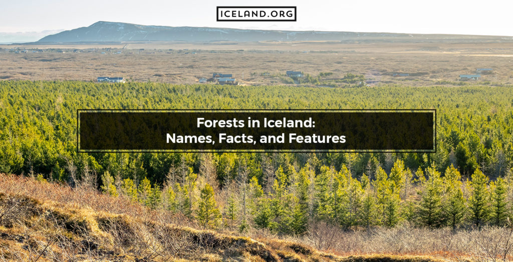
Before the Vikings came, Iceland was a densely forested land with tall trees and forests covering as much as 40% of its area. Today, with dedicated afforestation efforts, only 2% of Iceland’s surface is covered with forests. The massive deforestation occurred due to the Vikings using timber as the main source for energy and building. Because of the continuous afforestation in the past few years, iceland now has two types of forests, natural and artificial. The forests are marked by native and imported plants as well as several animal species common for arctic climates. With an area of 740 square kilometers, the biggest forest in Iceland is Hallormsstaðaskógur. This national forest is located in Eastern Iceland and is a mandatory stop for all visitors in this part of Iceland.
Here is a list of the Forests in Iceland:
- Akurgerði
- Arnaldsstaðaskógur
- Álfholtsskógur
- Ásabrekka
- Ásbyrgi
- Brynjudalsskógur
- Bæjarstaðaskógur
- Daníelslundur
- Einkunnir
- Elliðaárdalur
- Eyjólfsstaðaskógur
- Fossá
- Furulundurinn
- Gaddstaðaflatir
- Grundarreitur
- Guðmundarlundur
- Gunnfríðarstaðaskógur
- Hallormsstaðaskógur (740 square kilometers)
- Hamrahlíð
- Haukadalsskógur
- Haukadalur
- Hálsaskógur
- Hánefsstaðir
- Heiðmörk
- Hellisskógur
- Hofsstaðaskógur
- Hrútey
- Höfðaskógur
- Jafnaskarðsskógur
- Jórvíkurskógur
- Kirkjubæjarklaustur
- Kirkjuhvammur
- Kjarnaskógur
- Kristnesskógur
- Laugalandsskógur
- Laugarvatnsskógur
- Lágafell
- Leyningshólar
- Mela- og Skuggabjargaskógur
- Mógilsá
- Múlakot
- Norðurtunguskógur
- Rauðavatn
- Reykholtsskógur
- Reykjarhólsskógur
- Selskógur
- Sigríðarstaðaskógur
- Skarðsdalur
- Skógarhlíð
- Skógarreitur
- Snæfoksstaðir
- Sólbrekkuskógur
- Stálpastaðaskógur
- Svartiskógur
- Tröð
- Tumastaðir
- Tunguskógur
- Vaðlaskógur
- Vaglaskógur
- Vaglir
- Vatnshornsskógur
- Vinaskógur
- Vífilsstaðavatn
- Völvuskógur
- Þjórsárdalur
- Þórðarstaðaskógur
- Þórsmörk
- Öskjuhlíð
1. Akurgerði
Akurgerði Forest in Iceland is located in the north. The Akurgerði Forest is a recreational forest whose cultivation started around 1950. Today it has a rich flora and fauna. Tours and Tour Guides for the Akurgerði Forest in Iceland are available.
2. Arnaldsstaðaskógur
Arnaldsstaðaskógur Forest in Iceland is located in the east. Arnaldsstaðaskógur is a national forest set on a steep mountain slope and rich in birch trees. Tours and Tour Guides for the Arnaldsstaðaskógur Forest in Iceland are available.
3. Álfholtsskógur
Álfholtsskógur Forest in Iceland is located in the west. The Álfholtsskógur Forest’s coordinates are 64.3690° N, 21.8484° W. Álfholtsskógur is an old forest, but intense planting started in 1940. Today it is a popular recreational spot with spectacular views, lots of hiking trails, and camping spots. Tours and Tour Guides for the Álfholtsskógur Forest in Iceland are available.
4. Ásabrekka
Ásabrekka Forest in Iceland is located in the southwest. The Ásabrekka Forest has between 16 and 17 thousand plants, including birch, aspen, pine, and larch. Tours and Tour Guides for the Ásabrekka Forest in Iceland are available.
5. Ásbyrgi
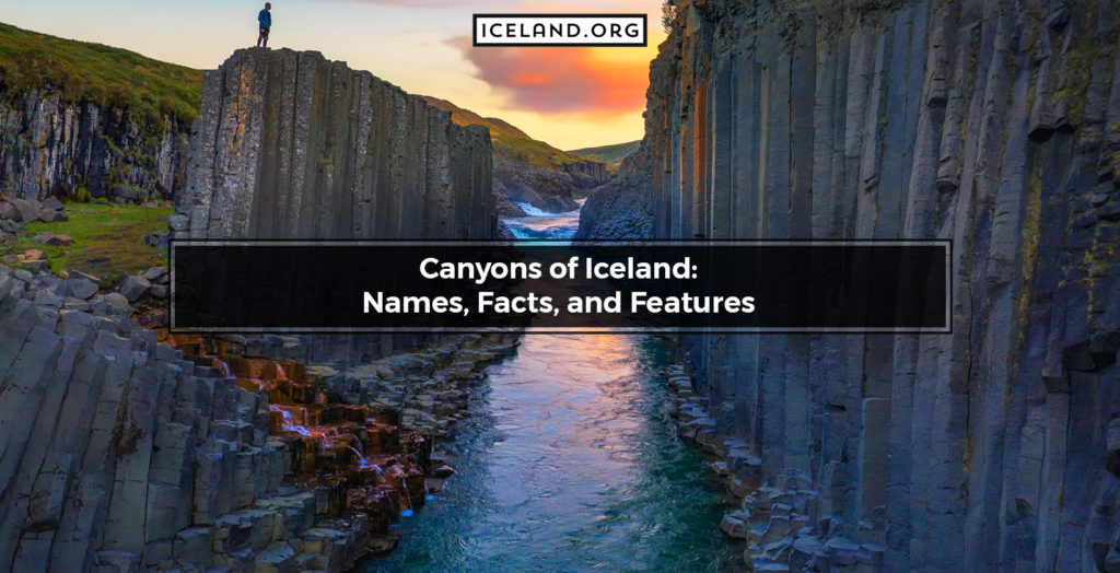
Ásbyrgi Forest in Iceland is located in the north. The Ásbyrgi Forest’s coordinates are 66.0178° N, 16.5055° W. Ásbyrgi is a national forest surrounded by the otherworldly landscapes of the Ásbyrgi canyon. The Ásbyrgi Forest is rich in native birch, rowen, and some conifer plants. Tours and Tour Guides for the Ásbyrgi Forest in Iceland are available.
6. Brynjudalsskógur
Brynjudalsskógur Forest in Iceland is located in the west. The Brynjudalsskógur Forest’s coordinates are 64.4705° N, 21.3156° W. Brynjudalsskógur is primarily used for Christmas tree cultivation, but the forest is also rich in wild berries like blueberries and raspberries. Tours and Tour Guides for the Brynjudalsskógur Forest in Iceland are available.
7. Bæjarstaðaskógur
Bæjarstaðaskógur Forest in Iceland is located in the southern parts of the island. The Bæjarstaðaskógur Forest’s coordinates are 64.0625° N, 17.0219° W. Featuring some incredibly tall trees, Bæjarstaðaskógur is one of the best birch and rowan forests in Iceland. Tours and Tour Guides for the Bæjarstaðaskógur Forest in Iceland are available.
8. Daníelslundur
Daníelslundur Forest in Iceland is located in the west. The Daníelslundur Forest’s coordinates are 64.8982° N, 21.5230° W. Daníelslundur is the first open forest in Iceland (since 2002). Tours and Tour Guides for the Daníelslundur Forest in Iceland are available. Tourists are asked to stick to the hiking trails in order to protect the sensitive vegetation.
9. Einkunnir
Einkunnir Forest in Iceland is located in the south. The Einkunnir Forest’s coordinates are 64.5987° N, 21.9113° W. Einkunnir is a country park used as a recreational area. The main hallmark of the Einkunnir park is the rocky bluffs arising from the flat wetlands. Tours and Tour Guides for the Einkunnir Forest in Iceland are available.
10. Elliðaárdalur
Elliðaárdalur Forest in Iceland is located in the southwest. The Elliðaárdalur Forest’s coordinates are 64.1196° N, 21.8461° W. Elliðaárdalur is a national forest and one of the famous green recreational areas near Reykjavik. Tours and Tour Guides for the Elliðaárdalur Forest in Iceland are available.
11. Eyjólfsstaðaskógur
Eyjólfsstaðaskógur Forest in Iceland is located in the east of the island. The Eyjólfsstaðaskógur Forest’s coordinates are 65.1800° N, 14.4793° W. Tours and Tour Guides for the Eyjólfsstaðaskógur Forest in Iceland are available.
12. Fossá
Fossá Forest in Iceland is located in the south. The Fossá Forest’s coordinates are 64.7559° N, 14.4990° W. Fossá is the woodland area and valley surrounding the Fossá River in Iceland (Fossárdalur). Tours and Tour Guides for the Fossá Forest in Iceland are available. Both the forest and the river got their names from the many waterfalls which mark the area and attract lots of tourists.
13. Furulundurinn
Furulundurinn Forest in Iceland is located in the west. Furulundurinn is a vast birch grove and one of the oldest cultivated forests in Iceland. Tours and Tour Guides for the Furulundurinn Forest in Iceland are available.
14. Gaddstaðaflatir
Gaddstaðaflatir Forest in Iceland is located in the southwest of the country. The Gaddstaðaflatir Forest’s coordinates are 63.8291° N, 20.4011° W. Tours and Tour Guides for the Gaddstaðaflatir Forest in Iceland are available as the area is a popular camping site. Hiking tours are also popular, especially during summer.
15. Grundarreitur
Grundarreitur Forest in Iceland is located in the north. Grundarreitur is rich in Swiss pine and Danish Aspen trees. Tours and Tour Guides for the Grundarreitur Forest in Iceland are available.
16. Guðmundarlundur
Guðmundarlundur Forest in Iceland is located in the southwest of the country. The Guðmundarlundur Forest’s coordinates are 64.0741° N, 21.8243° W. Tours and Tour Guides for the Guðmundarlundur Forest in Iceland are available.
17. Gunnfríðarstaðaskógur
Gunnfríðarstaðaskógur Forest in Iceland is located in the northwest of the island. The Gunnfríðarstaðaskógur Forest’s coordinates are 65.7912° N, 19.9530° W. Gunnfríðarstaðaskógur is a diverse forest with lots of yellow willows, birch, and pines. The forest is also rich in birdlife (especially fire owls) and foxes. Tours and Tour Guides for the Gunnfríðarstaðaskógur Forest in Iceland are available. Hiking and wildlife watching are of particular interest among visitors.
18. Hallormsstaðaskógur
Hallormsstaðaskógur Forest in Iceland is located in the east of the country. The Hallormsstaðaskógur Forest’s coordinates are 65.0989° N, 14.7208° W. Spreading over an area of 740 square kilometers, Hallormsstaðaskógur is the largest national forest in Iceland. Hallormsstaðaskógur is famous for its hiking trails, unique wildlife, and plant life species. Hallormsstaðaskógur is particularly rich in native dwarf birch and mountain birch. However, there are over 80 different types of plants and trees brought from worldwide. The Hallormsstaðaskógur Forest has been protected since 1905. Tours and Tour Guides for the Hallormsstaðaskógur Forest in Iceland are available.
19. Hamrahlíð
Hamrahlíð Forest in Iceland is located in the southwest. The Hamrahlíð Forest produces beautiful and sustainable Christmas trees. Tours and Tour Guides to the Hamrahlíð Forest in Iceland are available.
20. Haukadalsskógur
Haukadalsskógur Forest (Valley of hawks) in Iceland is located in the southwest. The Haukadalsskógur Forest’s coordinates are 64.3140° N, 20.3056° W. Haukadalsskógur is a national forest near the Laugarvatn lake. It houses some of the most popular geysers in Iceland, including the Strokkur and Geysir. Tours and Tour Guides for the Haukadalsskógur Forest in Iceland are available. Hiking and visiting the two popular geysers are the best tours for this forest.
21. Haukadalur
Haukadalur Forest in Iceland is located in the south. The Haukadalur Forest’s coordinates in Iceland are 64.3140° N, 20.3056° W. Haukadalur is a well-known geothermal area that houses many geysers such as Strokkur and Geysir. Tours and Tour Guides for the Haukadalur Forest in Iceland are available.
22. Hálsaskógur
Hálsaskógur Forest in Iceland is located in the east. The Hálsaskógur Forest’s coordinates are 64.0983° N, 21.8394° W. Hálsaskógur. Tours and Tour guides for the Hálsaskógur Forest in Iceland are available. The Hálsaskógur Forest area is ideal for taking light walks, meaning hiking tours are prevalent.
23. Hánefsstaðir
Hánefsstaðir Forest in Iceland is located in the east. The Hánefsstaðir Forest’s coordinates are 65.2867° N, 13.8707° W. Hánefsstaðir is marked by various forestry experiments. Tours and Tour Guides for the Hánefsstaðir Forest in Iceland are available.
24. Heiðmörk
Heiðmörk Forest in Iceland is located in the southwest. The Heiðmörk Forest’s coordinates are 64.0650° N, 21.7652° W. Heiðmörk is a national forest and popular recreational area. The Heiðmörk Forest has been planted with over 4 million trees in the last 50 years. Heiðmörk features 26 different tree species and over 150 wildflowers. With more than 60 bird species, Heiðmörk is also rich in birdlife. Tours and Tour Guides for the Heiðmörk Forest in Iceland are available.
25. Hellisskógur
Hellisskógur Forest in Iceland is located in the southwest. The Hellisskógur Forest’s coordinates are 63.9449° N, 20.9935° W. Hellisskógur is a small forest with lots of hiking trails and an exciting cave formed as a result of sea erosion during the latter glacial period. Tours and Tour Guides for the Hellisskógur Forest in Iceland are available. Popular tours include hiking and visiting the glacial cave.
26. Hofsstaðaskógur
Hofsstaðaskógur Forest in Iceland is located in the west. The Hofsstaðaskógur Forest’s coordinates are 64.8353° N, 22.8323° W. Tours and Tour Guides for the Hofsstaðaskógur Forest in Iceland are available.
27. Hrútey
Hrútey Forest in Iceland is located on an island in the Westfjords. The Hrútey Forest’s coordinates are 66.0986° N, 21.7264° W. In 2003, Hrútey was declared an open forest. Tours and Tour Guides for the Hrútey Forest and island in Iceland are available. Popular tours include hiking and bird watching.
28. Höfðaskógur
Höfðaskógur Forest in Iceland is located in the southwest. The Höfðaskógur Forest’s coordinates are 64.0391° N, 21.9203° W. Tours and Tour Guides for the Höfðaskógur Forest in Iceland are available.
29. Jafnaskarðsskógur
Jafnaskarðsskógur Forest in Iceland is located in the western parts of the island. The Jafnaskarðsskógur Forest’s coordinates are 64. 4518° N, 21.369° W. Jafnaskarðsskógur is an expansive national forest with mesmerizing walking paths and trails from which visitors can witness the many great views. Tours and Tour Guides for the Jafnaskarðsskógur Forest in Iceland are available.
30. Jórvíkurskógur
Jórvíkurskógur Forest in Iceland is located in the east. The Jórvíkurskógur Forest’s coordinates are 64.8578° N, 14.3881° W. Jórvíkurskógur is a national forest. Its woodlands are mainly marked by native birch shrubs and some planted conifers. Despite the harsh conditions, the Jórvíkurskógur Forest is one of the few Icelandic sites with low-growing, native quaking aspen. Tours and Tour Guides for the Jórvíkurskógur Forest in Iceland are available.
31. Kirkjubæjarklaustur
Kirkjubæjarklaustur Forest in Iceland is located in the south of the country. The Kirkjubæjarklaustur Forest’s coordinates are 63.7801° N, 18.0898° W. It used to be the largest private forest. However, since 1966 the supervision over the Kirkjubæjarklaustur Forest has been taken by the Icelandic Forest Service, which has planted numerous trees and built many walking trails. Today, some of the tallest trees in Iceland are growing in the Kirkjubæjarklaustur Forest. Tours and Tour Guides for the Kirkjubæjarklaustur Forest in Iceland are available.
32. Kirkjuhvammur
Kirkjuhvammur Forest in Iceland is located in the northwest. Kirkjuhvammur is a large camping site with different trees and hiking trails. Tours and Tour Guides for the Kirkjuhvammur Forest in Iceland are available.
33. Kjarnaskógur
Kjarnaskógur Forest in Iceland is located in the northeast. In the last fifty years, the Kjarnaskógur Forest has been enriched with over one million newly planted trees. Kjarnaskógur has over 210 plant species, with birch and larch being the most prominent. Tours and Tour Guides for the Kjarnaskógur Forest in Iceland are available. The Kjarnaskógur Forest offers opportunities for different sports, including running, hiking, biking, and skiing.
34. Kristnesskógur
Kristnesskógur Forest in Iceland is located in the north. With an area of 10 square kilometers, today, Kristnesskógur is a national forest close to the Akureyri town. In the past, it was used as a recreational area for patients from the nearby tuberculosis sanatorium. The 300-meters paved paths are still used for recreation and rehabilitation. Tours and Tour Guides for the Kristnesskógur Forest in Iceland are available.
35. Laugalandsskógur
Laugalandsskógur Forest in Iceland is located in the north. Laugalandsskógur grows various bushes and trees such as pine (including Christmas trees), birch, spruce, and larch. Laugalandsskógur has vast fields of mushrooms and wild berries. Tours and Tour Guides for the Laugalandsskógur Forest in Iceland are available.
36. Laugarvatnsskógur
Laugarvatnsskógur Forest in Iceland is located in the south. Laugarvatnsskógur is a large-scale national forest. It is made of birch bushes and some planted grooves, and tree species. Tours and Tour Guides for the Laugarvatnsskógur Forest in Iceland are available.
37. Lágafell
Lágafell Forest in Iceland is located in the southwest. The Lágafell Forest’s coordinates are 64.3489° N, 20.9550° W. Tours and Tour Guides for the Lágafell Forest in Iceland are available.
38. Leyningshólar
The Leyningshólar Forest’s coordinates are 65.3500° N, 18.3000° W. Leyningshólar is a hilly area marked by landslides and glacial ridges. The Leyningshólar Forest is the only region with native birch in the area. Tours and Tour Guides for the Leyningshólar Forest in Iceland are available.
39. Mela-og Skuggabjargaskógur
Mela-og Skuggabjargaskógur Forest in Iceland is located in the north. Mela-og Skuggabjargaskógur is a national forest and one of the greatest birchwoods in Iceland. The typical Icelandic downy Birch is particularly tall in the Mela-og Skuggabjargaskógur Forest. Mela-og Skuggabjargaskógur also has conifer plantations. Tours and Tour Guides for the Mela-og Skuggabjargaskógur Forest in Iceland are available.
40. Mógilsá
Mógilsá Forest in Iceland is located in the southwest. The Mógilsá Forest’s coordinates are 64.2091° N, 21.7096° W. Mógilsá is a national forest and one of the most popular recreational outdoor areas for Reykjavík people. Mógilsá is a mixed type of forest in proximity to Mount Esja with an unusual Alps-like structure and landscape. Tours and Tour Guides for the Mógilsá Forest in Iceland are available.
41. Múlakot
Múlakot Forest in Iceland is located in the southwest. The Múlakot Forest’s coordinates are 64.6939° N, 21.9229° W. Múlakot is a national forest marked by an arboretum of unique and rare species. Black cottonwood trees with over 20 meters of height grow in the Múlakot Forest. Also, the Múlakot forest is the first plant nursery center in south Iceland used for growing and multiplying black cottonwood and willow clones. Tours and Tour Guides for the Múlakot Forest in Iceland are available.
42. Norðurtunguskógur
Norðurtunguskógur Forest in Iceland is located in the west. Norðurtunguskógur originally consisted of birch bushes, but since 1950 it has been planted with other trees and coniferous plants. Tours and Tour Guides for the Norðurtunguskógur Forest in Iceland are available.
43. Rauðavatn
Rauðavatn Forest in Iceland is located in the southwest. The Rauðavatn Forest’s coordinates are 64.1078° N, 21.7712° W. Rauðavatn is a small grove area surrounding the Rauðavatn Lake. The grove is rich in mountain pines that were planted in the last century. Tours and Tour Guides for the Rauðavatn Forest in Iceland are available. Hikes and sightseeing are the most popular tours.
44. Reykholtsskógur
Reykholtsskógur Forest in Iceland is located in the west. The Reykholtsskógur Forest’s coordinates are 64.6668° N, 21.2963° W. Tours and Tour Guides for the Reykholtsskógur Forest in Iceland are available.
45. Reykjarhólsskógur
Reykjarhólsskógur Forest in Iceland is located in the north. Reykjarhólsskógur is a national forest. Tours and Tour Guides for the Reykjarhólsskógur Forest in Iceland are available. Reykjarhólsskógur is ideal for nice hikes and relaxing stops while traveling Route 1.
46. Selskógur
Selskógur Forest in Iceland is located in the west. The Selskógur Forest’s coordinates are 64.5260° N, 21.5789° W. Selskógur is a national forest with pleasant birch shrubs and sitka spruce and Norway spruce fields. The area close to Skorradalsvatn Lake has nice camping sites. Tours and Tour Guides for the Selskógur Forest in Iceland are available.
47. Sigríðarstaðaskógur
Sigríðarstaðaskógur Forest in Iceland is located in the north-east of the island. The Sigríðarstaðaskógur Forest’s coordinates are 65.7375° N, 17.7981° W. Marked by extensive and protected birchwood, Sigríðarstaðaskógur is a national forest. Tours and Tour Guides for the Sigríðarstaðaskógur Forest in Iceland are available.
48. Skarðsdalur
Skarðsdalur Forest in Iceland is located in the southeast of the country. The Skarðsdalur Forest’s coordinates are 66.1258° N, 18.9827° W. Skarðsdalur is a popular ski area in Iceland. Tours and Tour Guides for the Skarðsdalur Forest in Iceland are available.
49. Skógarhlíð
Skógarhlíð Forest in Iceland is located in the southwest. The Skógarhlíð Forest’s coordinates are 65.7024° N, 18.1573° W. Skógarhlíð is a small and idyllic forest just outside Iceland’s capital. Tours and Tour Guides for the Skógarhlíð Forest in Iceland are available.
50. Skógarreitur
Skógarreitur Forest in Iceland is located in the south. The Skógarreitur Forest’s coordinates are 63.7801° N, 18.0898° W. Skógarreitur is rich in birch and aspen, as well as some spruce, larch, and pine trees. The hiking trail to the Systrafoss Waterfall passes through Skógarreitur. Tours and Tour Guides for the Skógarreitur Forest in Iceland are available. Popular tours include hiking and visiting the nearby waterfall.
51. Snæfoksstaðir
Snæfoksstaðir Forest in Iceland is located in the southwest. The Snæfoksstaðir Forest’s coordinates are 64.0136° N, 20.8817° W. Torus and Tour Guides for the Snæfoksstaðir Forest are available.
52. Sólbrekkuskógur
Sólbrekkuskógur Forest in Iceland is located in the southwest of the island. The Sólbrekkuskógur Forest’s coordinates are 63.9514° N, 22.4329° W. It is a very small forest particularly rich in crowberries during late summer and early autumn. Tours and Tour Guides for the Sólbrekkuskógur Forest in Iceland are available.
53. Stálpastaðaskógur
Stálpastaðaskógur Forest in Iceland is located in the west. Stálpastaðaskógur is a hilly national forest. Stálpastaðaskógur’s arboretum features over 30 labeled plants and trees from over 70 different locations in the world. Tours and Tour Guides for the Stálpastaðaskógur Forest in Iceland are available as the forest is a popular destination for hikers. Stálpastaðaskógur is also a commercial forest contributing to timber production.
54. Svartiskógur
Svartiskógur Forest in Iceland is located in the northeast. The Svartiskógur Forest’s coordinates are 65.5146° N, 14.5650° W. Svartiskógur is a small woodland area. Tours and tour Guides for the Svartiskógur Forest in Iceland are available. Plus, there are cozy cabins for tourists in the area.
55. Tumastaðir
Tumastaðir Forest in Iceland is located in the southwest. The Tumastaðir Forest’s coordinates are 63.7404° N, 20.0629° W. Tumastaðir is a national forest. The Tumastaðir Forest is rich in versatile plant life. Perhaps the most important plants are the Sitka spruce stands, with the oldest specimen growing since 1944. The stand is called Lýðveldislundurinn (Republic Grove) because, in that year, Iceland got its independence and became a Republic. Tours and Tour Guides for the Tumastaðir Forest in Iceland are available. Tumastaðir is very good for recreation as it features easy access to paths and hiking trails.
56. Tunguskógur
Tunguskógur Forest in Iceland is located in the west. The Tunguskógur Forest’s coordinates are 66.0608° N, 23.2041° W. The Tunguskógur Forest is naturally shielded from bad weather and features beautiful waterfalls. Tours and Tour Guides for the Tunguskógur Forest in Iceland are available. Tunguskógur Forest is very close to the town of Ísafjörður, which is quite busy and probably the largest settlement in the Westfjords.
57. Vaðlaskógur
Vaðlaskógur Forest in Iceland is located in the north. Vaðlaskógur is woodland consisting of birch and coniferous plants, including Siberian pine, garden maple, ash, spruce, linden, elm, and white pine. The plantation of Vaðlaskógur started in 1936. Tours and Tour Guides for the Vaðlaskógur Forest in Iceland are available.
58. Vaglaskógur
Vaglaskógur Forest in Iceland is located in the north. The Vaglaskógur Forest’s coordinates are 65.7178° N, 17.8795° W. Vaglaskógur is a national birch and spruce forest. Vaglaskógur is one of the most beautiful and the second largest forest in Iceland. The gurgling Fnjóská River flows through the Vaglaskógur Forest. Tours and Tour Guides for the Vaglaskógur Forest in Iceland are available. Vaglaskógur is very close to the town of Akureyri and features many hiking trails and beautiful campsites.
59. Vaglir
Vaglir Forest in Iceland is located in the north. The Vaglir Forest’s coordinates are 65.5167° N, 19.2833° W. Vaglir is a national forest with various plant and tree species and vivid landscapes. Tours and Tour Guides for the Vaglir Forest in Iceland are available. It has the potential to become the most important recreation forest in the Akureyri area.
60. Vatnshornsskógur
Vatnshornsskógur Forest in Iceland is located in the west. The Vatnshornsskógur Forest’s coordinates are 64.492°N, 21.3773° W. Vatnshornsskógur is a national forest. Tours and Tour Guides for the Vatnshornsskógur Forest in Iceland are available.
61. Vinaskógur
Vinaskógur Forest in Iceland is located in the south. The Vinaskógur Forest’s coordinates are 64.2423° N, 21.1856° W. Vinaskógur is a small forest within the Þingvellir National Park. Torus and Tour Guides for the Vinaskógur Forest are available. The national park, together with the forest, is part of the famous Golden Circle tour.
62. Vífilsstaðavatn
Vífilsstaðavatn Forest in Iceland is located in the southwest. The Vífilsstaðavatn Forest’s coordinates are 64.0788° N, 21.8716° W. Vífilsstaðavatn is the forest surrounding the Vífilsstaðavatn lake which features wildflowers. Tours and Tour Guides for the Vífilsstaðavatn Forest are available. The lake and surrounding forest area are attractive to tourists because they are close to the capital and with many walking and hiking trails.
63. Völvuskógur
Völvuskógur Forest in Iceland is located in the south. The Völvuskógur Forest’s coordinates are 63.7871° N, 19.4890° W. Völvuskógur is rich in dahuri larch hybrids, Russian larch, Sitka spruce, and Alaska spruce. Tours and tour guides for the Völvuskógur Forest in Iceland are available.
64. Þjórsárdalur
Þjórsárdalur Forest in Iceland is located in the southwest. The Þjórsárdalur Forest’s coordinates are 64.1097° N, 19.9597° W. Þjórsárdalur is a national forest that lies between mount Búrfell mount Skriðufell. Þjórsárdalur is dispersed over two valley floors, Bergólfsstaðaá in the west and Rauðukamba in the east. The Þjórsá river runs through the Þjórsárdalur Forest and features several waterfalls, including Gjáin and Háifoss. Þjórsárdalur’s landscape is frequently modified by the activity of the nearby Hekla volcano. Tours and Tour Guides for the Þjórsárdalur Forest in Iceland are available.
65. Þórðarstaðaskógur
Þórðarstaðaskógur Forest in Iceland is located in the northern parts of Iceland. The Þórðarstaðaskógur Forest’s coordinates are 65.6250° N, 17.8100° W. Þórðarstaðaskógur is one of Iceland’s national forests. Tours and Tour Guides for the Þórðarstaðaskógur Forest in Iceland are available. The forest is popular for visitors because of the many hiking trails, and it is very close to the Illugastaðir tourist attraction.
66. Þórsmörk
Þórsmörk Forest in Iceland is located in the southwest. The Þórsmörk Forest’s coordinates are 63.6807° N, 19.4826° W. Þórsmörk is a national forest and one of the most popular hiking destinations in Iceland. Þórsmörk is surrounded by rivers and glaciers and features a warmer climate than the rest of south Iceland. The Þórsmörk Forest is rich in vegetation fern, moss, birchwood, and other smaller shrubs. Tours and Tour Guides for the Þórsmörk Forest in Iceland are available.
67. Öskjuhlíð
Öskjuhlíð Forest in Iceland is located in the southwest. The Öskjuhlíð Forest’s coordinates are 64.1288° N, 21.9196° W. Öskjuhlíð is, in fact, a woodland hill in the capital Reykjavik’s center. At the top of the Öskjuhlíð Hill is the Perlan landmark center which was used as a water tank and now is open to the public. Öskjuhlíð is an artificial forest that natives started to rejuvenate around 1950. Today, there are over 80 different tree species in Öskjuhlíð, including birches, spruces, pines, and aspens. Tours and Tour Guides for the Öskjuhlíð Forest in Iceland are available. The area is marked by many hiking trails and a popular destination for both natives and tourists.
What are the facts about Forests in Iceland?
In Iceland, there are over 53 forests (and green areas) under the directions and control of the Icelandic Forest Service. Basically, any outdoor and grassy area protected by the Icelandic Forest Service is considered to be a national forest. These forests and other amenities and sights attract two million tourists per year. Some forests are natural, others are artificial, and some are easily accessible, while others are in more remote locations. Exploring the forests in Iceland requires a 4×4 vehicle and some physical conditions, especially for visitors interested in hiking.
How many Forests are there in Iceland?
Based on current information, there are 53 forests in the Icelandic Forest Service. There are many other forests, hills, and woodland areas, but they are not covered with this national service program.
What is the biggest Forest in Iceland?
The biggest forest in Iceland is the Hallormsstaður National Forest, located in the eastern part of the country. Hallormsstaður became protected in 1905, and since then, its wildlife and plant life have been booming. Hallormsstaður is a great tourist attraction and offers an opportunity for outdoor recreation and sports.
What are the Natural Forests in Iceland?
The natural forests in Iceland are Ásbyrgi, Hallormsstaðaskógur, Jórvíkurskógur, Arnaldsstaðaskógur, Selskógur, Vaglaskógur, Vaglir, Leyningshólar, etc.
What are the Artificial Forests in Iceland?
The artificial forests in Iceland are Akurgerði, Álfholtsskógur, Brynjudalsskógur, Furulundurinn, Hamrahlíð, Kirkjubæjarklaustur, Rauðavatn, Stálpastaðaskógur, Múlakot, etc.
How much area do forests cover in Iceland?
Today, it is estimated that around 2% of Iceland’s territory is covered with forests. In the past, this number was much more significant and varied between 25% and 40%. However, the irresponsible use of timber took its toll, and now Iceland is facing the consequences.
How is the Living Structure in Iceland Forests?
Icelandic forests are symbiotic ecosystems in which native and imported plant species live together with local wildlife, including mammals, birds, and even insects. Each member structure has its role and is critical for managing the forest’s ecosystem in balance.
What kind of Trees are there in the Forests of Iceland?
The three main native tree species in Iceland include Aspen, Birch, and Rowan. Considering the ongoing global warming, it is becoming harder for these trees to thrive in Iceland. Therefore, recent afforestation efforts focus on planting new species imported from all over the world.
What kind of Animals are there in the Forests of Iceland?
Animals in Iceland can be found in different habitats. The forests are usually rich in Arctic foxes, mice, rats, minks, rabbits, and reindeers. There is also a versatile birdlife including 416 different species like the barrow’s goldeneye, common snipe, yellow-nosed albatross, etc.
What is the prominence of Forests in Iceland Geography?
Forests have a huge impact on Iceland’s Geography. For years they have been used for energy (heating) and building (houses and boats). This was helpful for the overall economy as people did not have to rely on imported goods for such purposes.
Which Region of Iceland does have the most Forests?
The Southern and Western Regions of Iceland have the highest number of forests. Plus, most of the forests in these Iceland’s regions are part of the country’s 26 national forests, which are protected by law. In contrast, the central parts of Iceland are scarce with forests.
What are the Settlements near Forests in Iceland?
Cities in Iceland are built close to forests. For example, Iceland’s capital is close to several forests. Plus, there is a small forest inside the capital itself, Öskjuhlíð. The Öskjuhlíð Forest is a real attraction for tourists and a great recreational area for locals. Another town with forests in its proximity is Akureyri.
What are the Nature Tours in Iceland?
Nature Tours in Iceland are a popular activity for tourists. Forests, with their natural beauty and streams, rivers, glaciers, and unusual wildlife and plants, are attracting many visitors. There are different tours with prices starting from $60 and above.
Is It Legal to Enter Forests in Iceland?
Yes, it is legal to enter forests in Iceland. All forestry-related issues are solved through The Icelandic Forestry Service.
What is the History of Forests in Iceland?
The History of Forests in Iceland is exciting and unusual. Namely, in the past, the country had dense forests covering almost half of its area. However, lacking other resources, the first settlers used timber for both energy sources and building houses and boats. The massive use of timber leads to severe deforestation. Today, there are focused efforts for afforestation, and as a result, there are once again trees growing in Iceland.
